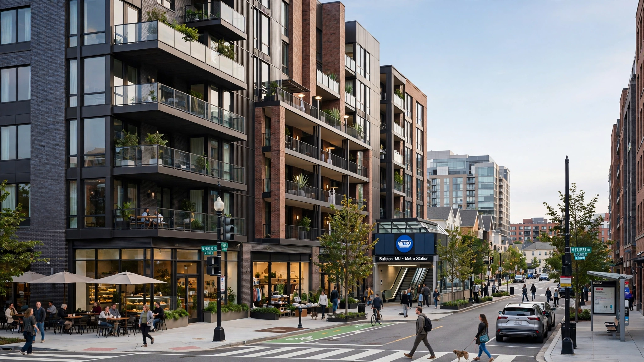
Arlington Homes for Sale & Real Estate Guide
Arlington is 26 square miles directly across the Potomac from DC — the smallest self-governing county in the U.S. No incorporated towns, just urban villages along Metro, tree-lined neighborhoods, and riverfront trails stitched together by one county government.
Served by Arlington Public Schools — verify assignment by address. County: Arlington County. Verify any address via official GIS and district locator. No commute estimates relied upon.
Why People Consider Arlington
- Transit-first buyers who want 11 Metro stations without Fairfax distance
- Urban-village living with Reagan National ten minutes away
- Compact-lot buyers who value trails, parks, and walkable retail over yard size
- Federal and tech commuters who want Crystal City, Pentagon, and Rosslyn access
Housing & Neighborhoods
Subdivision names reflect county plat and HOA documentation — verify specific address via official GIS.
Rosslyn-Ballston Corridor
High-rise condos and 1910s-1930s infill around Court House and Clarendon, walkable to Orange and Silver and packed with restaurants and shops.
Consider: High-rise HOA and parking limits — verify deeded spaces.
Crystal City / Pentagon City / Arlington Ridge
National Landing core with Amazon HQ2 adjacency, repositioned retail, and Long Bridge Park at your doorstep.
Consider: Condo HOA with structured parking and amenity covenants.
North Arlington / Lyon Village / Cherrydale
1920s-1950s craftsman and expanded colonial streets near Arlington Blvd and Langston Blvd — tree-lined and residential.
Consider: Teardown market — check lot width and permit history.
Columbia Pike / Shirlington
Revitalized main street under Form Based Code with mixed-use, independent dining, and Green Valley historic charm.
Consider: Form Based Code setbacks and frontage rules affect additions.
Getting Around
Major roads: I-66, US-50 Arlington Blvd, Wilson Blvd, Langston Blvd (US-29), Columbia Pike, Richmond Highway (US-1), George Washington Parkway. Metro/VRE: Eleven Metro stations across Orange, Silver, Blue, and Yellow lines, plus VRE at Crystal City and 100+ Capital Bikeshare stations. Check WMATA.com / VRE.org. No commute estimate.
What Buyers Should Know
Arlington is all public water from the Washington Aqueduct — no wells. Many Metro-corridor condos and townhomes have site-plan conditions that limit parking to one space, and 1960s-70s condos need a careful reserve review. School feeders can split inside the Rosslyn-Ballston corridor, so verify by address.
Schools
Arlington is served by Arlington Public Schools — verify assignment by address. Assignments vary by address and boundaries change. Verify via official locator. We do not rank schools.
What Sellers Should Know
Lead with three Metro lines plus VRE to separate Arlington from Fairfax distance. Highlight walkability to Wilson and Columbia Pike retail, Long Bridge Aquatics, and five-mile DC proximity. Stage for transit-first buyers who value Reagan National and trail connectivity.
FAQs — Arlington
Is Arlington a city or county?
A county with no incorporated towns, governed by a five-member County Board. At 26 square miles, it's the smallest self-governing county in the U.S., formed from retrocession of DC's original square in 1846.
How many Metro lines serve Arlington?
Four. Orange and Silver share Rosslyn through Ballston, Blue serves Cemetery to National Airport, Yellow parallels Blue from Pentagon, plus VRE at Crystal City.
Can I walk through Arlington National Cemetery?
No — it's 624 acres under the Department of the Army with controlled entry via Memorial Ave and security screening, not a neighborhood cut-through.
What schools serve Arlington?
Arlington Public Schools with four high schools — Yorktown, Washington-Liberty, Wakefield, and Arlington Tech — plus middle schools that split by corridor. Verify by address.
What's Long Bridge Park?
A 114-acre park in National Landing with aquatics center opened in 2021, turf fields, and direct Mount Vernon Trail connection.
Looking for current Arlington market stats? Market stats expire fast — see dated Journal.
Browse JournalLive Search
Explore Homes for Sale in Arlington
Live MLS search — map, filters, saved searches, and new-listing alerts.
Sources: Arlington County — Comprehensive Plan and GIS • WMATA — Metrorail Stations in Arlington • Arlington Public Schools — Boundary Locator • Virginia Railway Express — Crystal City Station · ZIP — ZIP does not equal neighborhood; verify address via GIS.
Nearby — Explore Around Arlington
Comparing areas? These guides break down governance, lot, HOA, and transit at the address level.
Arlington urban village buyers also explore Alexandria for waterfront walkability and
Falls Church for inside-Beltway schools. Each connects to the broader DMV for schools, commute, and lifestyle comparison.